Expert Slide and Photo Scanning Since 2002.
4,000 ppi Scanning and Premium Photoshop
Editing On Every Scan. 49¢ most slides.
We also can make PRINTS from your Slides.
Montana 35mm Slide, Photo & Film Scanning

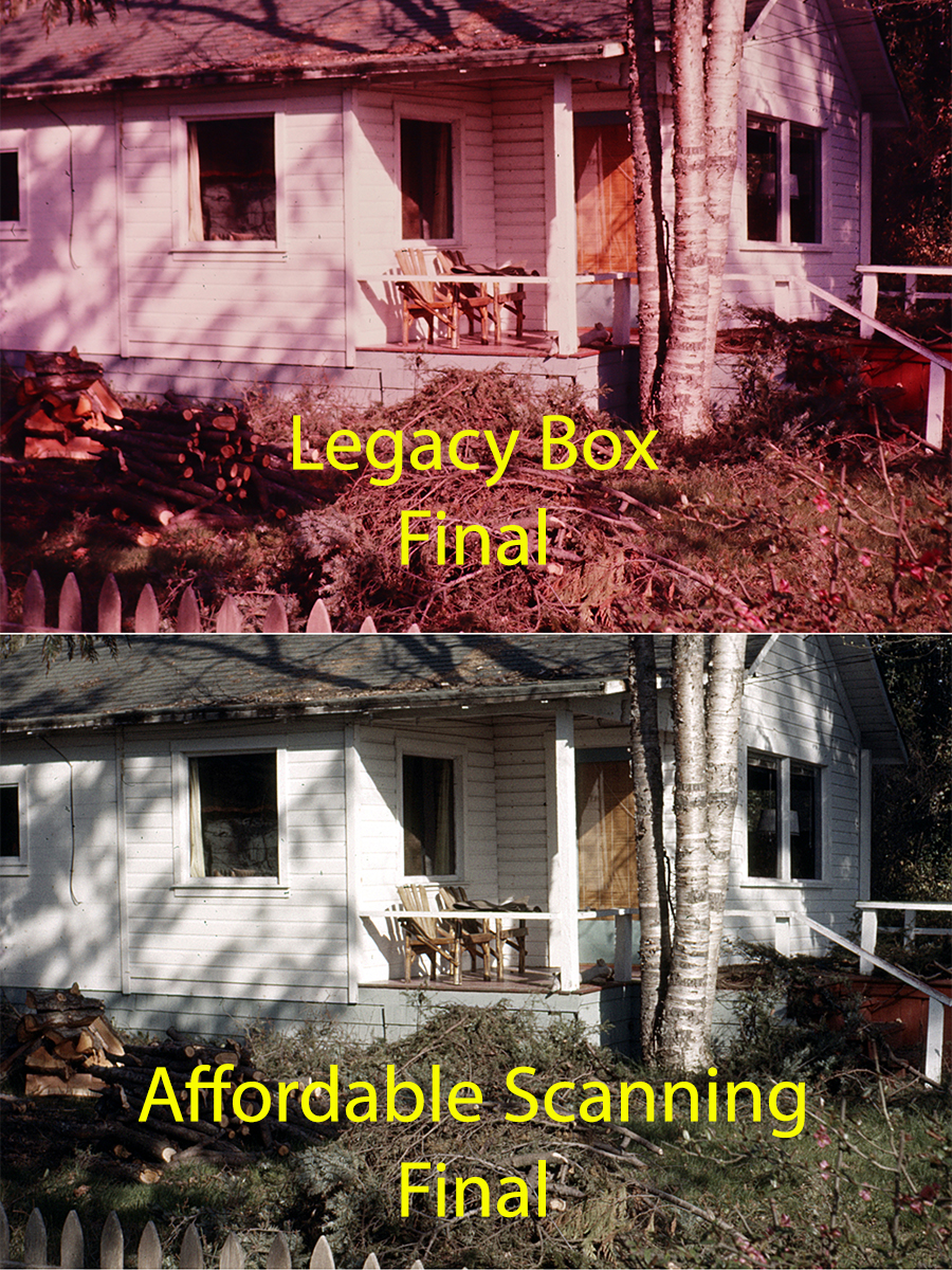
All Scanning companies will NOT give you the same results, Click Here.
While we do NOT have a local office in Montana, Affordable Scanning Services LLC has provided services for customers all over Montana, including Billings, Missoula, Great Falls, Bozeman, Butte, Silver Bow, Helena, Kalispell, Havre, Anaconda–Deer Lodge County, Miles City, and the United States and Canada since 2002. In all that time we have worked with multiple people, university's and businesses with many different needs and end results. Our customers are very important to us and they are our best salespeople.
Some of the newer scanning companies, unable to compete with our services, have resorted to sending their customer's 35mm slides, photos and films to India or other third world countries. That is bad enough but what we think is really underhanded, is that they are not up front about this minor little detail. Most of their customers have no idea that their family photo collction is being loaded into a cargo plane and flown 7,000 miles over the ocean to India. And that may be the safest part of the trip.
At Affordable 35mm Slide Scanning, your job does not leave our premises,in Waupun Wisconsin, until we return ship to you. We treat your precious photo collection just like it was our own and I can tell you for certain, that we would never be sending our heirloom family photos to a thirdworld sweatshop in order to save a few dollars.
All jobs are worked by 100% USA citizens who are talented and skillful and they really are artists at heart. They work your family photos just like they were working their very own photos. We realize that this is the only time that you are going to be converting your slides and photos to digital and we are going to make it a good Experience for you.
Montana
"With a land area of 145,552 square miles (376,978 km²) the state of Montana is the fourth largest in the United States (after Alaska, Texas, and California). To the north, Montana and Canada share a 545 mile (877 km) border. The state borders the Canadian provinces of British Columbia, Alberta, and Saskatchewan, more provinces than any other state. To the east, the state borders North Dakota and South Dakota. To the south is Wyoming and to the west and southwest is Idaho.
The topography of the state is diverse, but roughly defined by the Continental Divide, which runs on an approximate diagonal through the state from northwest to south-central, splitting it into two distinct eastern and western regions. Montana is well known for its mountainous western region, part of the northern Rocky Mountains. However, about 60% of the state is actually prairie, part of the northern Great Plains. Nonetheless, even east of the Continental Divide and the Rocky Mountain Front, there are a number of isolated "Island Ranges" that dot the prairie landscape.
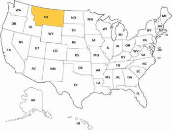
Map of MontanaThe Bitterroot Mountains divide the state from Idaho to the west with the southern third of the range blending into the Continental Divide. Mountain ranges between the Bitterroots and the top of the Continental Divide include the Cabinet Mountains, the Missions, the Garnet, Sapphire, Flint Creek, and Pintlar ranges.
The northern section of the Divide, where the mountains give way rapidly to prairie, is known collectively as the Rocky Mountain Front and is most pronounced in the Lewis Range located primarily in Glacier National Park. Due to the configuration of mountain ranges in Glacier National Park, the Northern Divide (which begins in Alaska's Seward Peninsula) crosses this region and turns east in Montana at Triple Divide Peak. Thus, the Waterton, Belly, and Saint Mary rivers flow north into Alberta, Canada, joining the Saskatchewan River and ultimately emptying into Hudson Bay.
East of the Divide, several parallel ranges march across the southern half of the state, including the Gravelly Range, the Tobacco Roots, the Madison Range, Gallatin Range, Big Belt Mountains, Bridger Mountains, Absaroka Mountains, and the Beartooth Mountains. The Beartooth Plateau is the largest continuous land mass over 10,000 feet (3,000 m) in the lower 48 states and contains the highest point in the state, Granite Peak, 12,799 feet (3,901 m) high.
St. Mary Lake in Glacier National ParkBetween the mountain ranges are many scenic valleys, rich in agricultural resources and rivers, and possessing multiple opportunities for tourism and recreation. Among the best-known areas are the Flathead Valley, Bitterroot Valley, Big Hole Valley, and Gallatin Valley.
East and north of this transition zone are expansive sparsely populated Northern Plains, with rolling tableland prairies, "island" mountain ranges, and scenic badlands extending into the Dakotas, Alberta, Saskatchewan, and Wyoming. The isolated island ranges east of the Divide include the Castle Mountains, Crazy Mountains, Little Belt Mountains, Snowy Mountains, Sweet Grass Hills, Bull Mountains. The Pryor Mountains South of Billings and, in the southeastern corner of the state near Ekalaka, the Long Pines and Short Pines.
The area east of the divide in the north-central portion of the state is known for the dramatic Missouri Breaks and other significant rock formations. Three stately buttes south of Great Falls are familiar landmarks. These buttes, Square Butte, Shaw Butte, and Crown Butte, are made of igneous rock, which is dense and has withstood weathering for many years. The underlying surface consists of shale. Many areas around these buttes are covered with clay surface soils. These soils have been derived from the weathering of the Colorado Formation. Farther east, areas such as Makoshika State Park near Glendive, and Medicine Rocks State Park near Ekalaka also highlight some of the most scenic badlands regions in the state.
Montana also contains a number of rivers, many of which are known for "blue-ribbon" trout fishing, but which also provide most of the water needed by residents of the state, as well as being a source of hydropower. Montana is the only state in the union whose rivers form parts of three major North American watersheds: The Pacific Ocean, the Gulf of Mexico, and Hudson Bay which are divided atop Triple Divide Peak in Glacier National Park.
Missouri Breaks region in central MontanaWest of the divide, the Clark Fork of the Columbia (not to be confused with the Clarks Fork of the Yellowstone River) rises in the Rocky Mountains near Butte and flows northwest to Missoula. There it is joined by the Blackfoot River and Bitterroot River and further downstream by the Flathead River before entering Idaho near Lake Pend Oreille, becoming part of the Columbia River, which flows to the Pacific Ocean. The Clark Fork discharges the greatest volume of water of any river exiting the state. The Flathead River and Kootenai River also drain major portions of the western half of the state.
East of the divide, the Missouri River, formed by the confluence of the Jefferson, Madison, and Gallatin rivers, crosses the central part of the state, flows through the Missouri breaks and enters North Dakota. The Yellowstone River rises in Yellowstone Park in Wyoming, flows north to Livingston, Montana, where it then turns east and flows across the state until it joins the Missouri River a few miles east of the North Dakota boundary. The Yellowstone River is the longest undammed, free-flowing river in North America. Other major Montana tributaries of the Missouri include the Milk, Marias, Tongue, and Musselshell Rivers. Montana also claims the disputed title of possessing the "world's shortest river," the Roe River, just outside Great Falls, Montana. These rivers ultimately join the Mississippi River and flow into the Gulf of Mexico.
Water is of critical importance to the state for both agriculture and hydropower. In addition to its rivers, the state is home to Flathead Lake, the largest natural fresh-water lake in the United States west of the Great Lakes. Man-made reservoirs dot Montana's rivers, the largest of which is Fort Peck Reservoir, on the Missouri river, contained by the largest earth-filled dam in the world.
Vegetation of the state includes ponderosa pine, lodgepole pine, larch, fir, spruce, aspen, birch, red cedar, ash, alder, rocky mountain maple and cottonwood trees. Forests cover approximately 25% of the state. Flowers native to Montana include asters, bitterroots, daisies, lupins, poppies, primroses, columbine, lilies, orchids and dryads. Several species of sagebrush and cactus and many species of grasses are common. Many species of mushrooms and lichens are also found in the state.
Montana contains Glacier National Park and portions of Yellowstone National Park, including three of the Park's five entrances. Other federally recognized sites include the Little Bighorn National Monument, Bighorn Canyon National Recreation Area, Big Hole National Battlefield, Lewis and Clark Caverns, and the National Bison Range. Montana has eight National Forests and over 20 National Wildlife Refuges. The Federal government administers 36,000,000 acres (146,000 km²). 275,000 acres (1,100 km²) are administered as state parks and forests."
From:
https://en.wikipedia.org/wiki/Montana
|
About Our Company Copyright 2024 |
|
Email: Click Here After hours you will get a quicker response by using email. We answer email at ALL hours. Telephone messages are replied to during business hours. Affordable Scanning Services LLC 400 Bittersweet Lane Waupun, WI 53963
|

 Home
Home Order Forms


